Well, the beginning of the road trip blogs. It has been crazy. There have been many blog worthy moments thus far. I am sure that there are more to come as well! Before I begin though, everyone needs to place Southern Utah on their bucket list.
Here is the driving map. I figured it would be easier for me to discuss with a road map so that you can get some visualization of the trip. Total mileage on Day 1... 335 miles. Obviously, Point A was Park City and we first went to Point B to visit friends in Salt Lake City. From there, we were advised to take highway 6 for a more scenic route. We also decided that our goal today was to hike this place...
How beautiful is this? So we drove to Capitol Reef in order to find the Swell. We in fact ended up below. Did I mention that it was pouring rain? The entire drive? And that we were going to be camping this night?
We also discovered that cars don't do so well in mud. It is scarier to drive in than snow. Another discovery, the "Swell" is actually the "Wave" that is in Coyote Buttes farther south in Utah. It requires a permit to hike it and you have to enter a lottery to do so. I am doing it one day. It looks absolutely incredible.
We then continued driving. The rain was looking pretty grim. But the sun started to shine through towards the west as we let the puppies out at Goblin State Park (point E). From here you could see the Henry Mountains in the distance where Butch Cassidy hid out and one of the only free roaming buffalo/bison herds exist. Apparently very rugged land. Would love to do it one day.
From there we continued on to try and find a place to camp. This trip has been tricky because National Parks do not allow dogs on any hikes. They allow them in the campsites and on paved roads which normally consist solely of the parking lots. So, we decided to stick to BLM land (Burea Land Management). This land is free to use, free to camp on, and free to hike on with your dogs. Here are some of the things that we saw in route to camping.
We ended up camping at Point G, which is known as Cathedral Valley. It was right next to the river amongst beautiful towering rocks. The ground consisted of red sand, which made for some very happy puppies. Luckily, we were able to avoid the rain, but we were not able to avoid stove malfunctions (ended up building a fire).
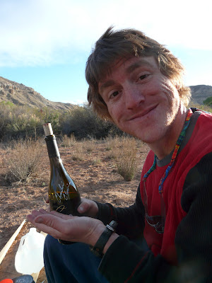
Enjoying a lovely bottle of cashmere signed by the maker himself.
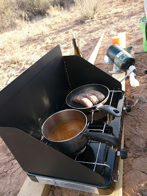
The stove prior to malfunction. If you can tell, the propane tank is pointed upwards. I decided it could be smart to read the directions. The bottle is supposed to be at a 45 degree angle downwards. Hence, the malfunctioning.
Well, successful road trip so far. More to come in the next days!
~ J


No comments:
Post a Comment